
UK weather forecast: Thunderstorms to HAMMER Britain before heatwave strikes
24 June 2019, 09:34

Britain is facing a few days of severe rainfall, thunder and lightening before the scorching weather arrives this weekend
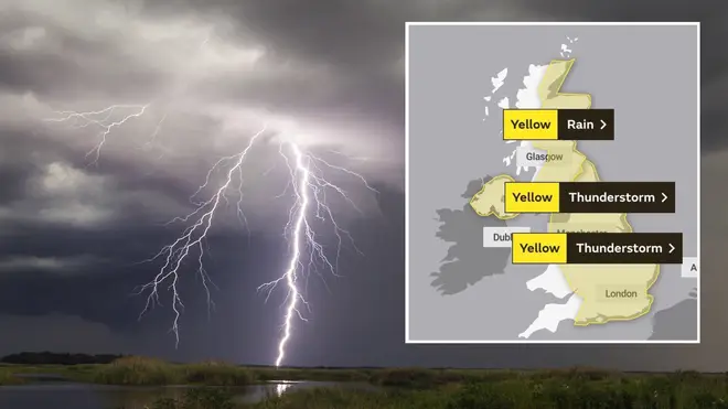
Thunder, lightning and heavy rain is set to strike the UK today ahead of this weekend's soaring heatwave.
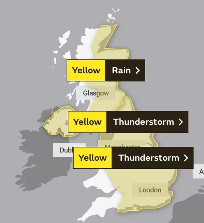
The Met Office has issued severe weather warnings across most of Britain for Monday as the country awaits dramatic thunderstorms before the Spanish plume sweeps in.
Areas in the north-east are reportedly suffering a 60-hour blanket of bad weather and the lack of sunshine is hitting most of England.
Weather experts are urging people in affected zones to take caution under the safety warning and brace for the brutal rainfall.
The Met Office have also issued Heat Health alerts in conjunction with Public Health England as temperatures will remain high despite the wet weather.
Thankfully, sunnier climes aren't far behind as Met Office Chief Meteorologist Dan Suri assures Brits the heatwave is on its way.
He said: “It’s going to feel much hotter for most areas across the UK this week.
“Our latest forecasts show the highest temperatures are expected towards the end of the week."
These areas are most likely to be "across central and southwest England, where temperatures could rise into the low 30s Celsius".
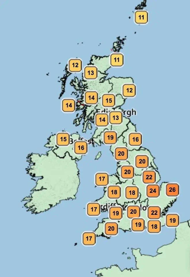
He added: “This will be in stark contrast to the low temperatures we’ve had so far this June.
“It’s also going to feel humid and quite muggy - especially at night time - as temperatures could remain in the high teens or low 20s Celsius in places.”
But as we know, hot and humid atmospheres are usually a marker of heavy thunderstorms.
He explained: “Whilst some places within warning areas could miss thunderstorms altogether and enjoy a warm, bright day, where they do develop torrential downpours, hail, lightning and gusty winds are likely.
“With the potential for a large volume of water in a short time, there is a significant risk of flash flooding, fast flowing or deep flowing water causing danger to life and very difficult driving conditions in places.”
The Met Office said the change in weather comes from "an omega blocking pattern in the north Atlantic," which means the UK is stuck under an area of low pressure causing rain and thunderstorms.


