
New weather chart shows 'entire country' covered in deep snow next week
12 January 2024, 12:50
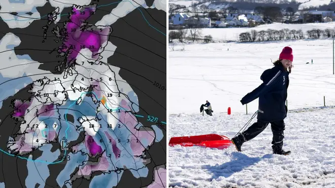


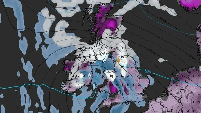
A weather chart has forecast snow for the UK next week.
Listen to this article
Loading audio...
A new weather chart has forecast the 'entire country' to be covered in snow next week, after the Met Office warned of an Arctic blast heading to the UK.
Maps released by WXCHARTS shows the country blanketed by deep snow by 20th January, with northern areas experiencing the most snowfall.
This latest news comes after the Met Office spoke of 'wintry hazards' next week and issued Yellow weather warnings for snow and ice for northern parts of Scotland on Monday 15th January and Tuesday 16th January. Northern Ireland has also been issued a Yellow weather warning for snow and ice on Tuesday 16th January.
The Met Office have warned these areas could experience 'frequent snow showers' with a chance that roads and railways will be affected with longer journey times.
Met Office Deputy Chief Meteorologist Chris Bulmer explained: "Snow showers from Sunday onwards are most likely to move inland from coasts exposed to northerly winds. The focus of snow showers will be over northern Scotland, but parts of the North Sea and Irish Sea coasts may also see some snow at times.
"There are a couple of weather systems for Tuesday and Wednesday which we are keeping an eye on that bring the potential for disruptive snow for some regions. With cold air firmly in place, any weather systems that move across the country next week will bringing mainly snowfall inland. Models are currently showing us a variety of options for both systems and we’ll be able to add more details to in the coming days."

When forecasting the weather for next week, Met Office meteorologist Aidan McGivern stated: "We start with a northerly airflow and snow showers, especially near the coasts in the north. But there will also be brighter skies for some.
"Then, from the middle of next week, low pressure tries to move in from the South West, and the impact of this is still a bit uncertain at this range.
"Different models are saying different things in terms of the track of this low, but you have the ingredients for snow with cold air in place and additional moisture supplied from the Atlantic, which will bring rain, but on the boundary with the cold air, you could see some snow."

Met Office Deputy Chief Forecaster Tony Wardle concurred: "There is the potential for some disruptive snow through the middle to latter part of next week as warmer Atlantic air attempts to push in from the southwest.
"As this occurs, some substantial snow could fall in some places, but the details of that are uncertain at the moment."

The Met Office long range forecast for Monday 15th January- Wednesday 24th January, states conditions will be:
"Often cloudy across clearing central and southern areas at first. Thereafter, turning colder from the North, with brisk northerly winds likely developing widely across of the UK, bringing a risk of snow showers, most frequent across the north.
"Temperatures remaining cold, and a marked wind chill especially in the north. There is risk of unsettled weather pushing in from the south through this period, which could lead to a band of snow and sleet where it meets the colder air across the country.
"Confidence is low with regards the timing of the arrival of any such disturbance, but there is an increasing risk of something potentially disruptive at some point in this period. Widespread frosts continue to be a feature by night, with a risk of ice in places."
Read more:
- When is it too cold to walk your dog?
- Drivers shocked over 'magic' button which defrosts car windscreen in seconds
- Women feel the cold more than men, expert explains