
UK weather: Scandinavian blast to bring subzero temperatures this weekend
18 March 2021, 10:29 | Updated: 18 March 2021, 10:32


Britain will be hit by a 'Scandinavian blast' from tomorrow as temperatures plunge across the country.
We might have experienced some warmer weather over the past week, but Britain is set to be hit by Scandinavian blast this weekend.
The cold air will cause temperatures to plummet and bitter winds will hit much of the south east starting tomorrow.
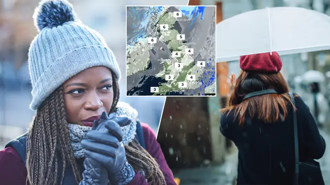
According to the Express, data from WXCHARTS sees blue and white swirls moving towards the east of Britain from a northerly direction.
This could cause the mercury to dip as low as 0C on Saturday in eastern areas such as London, Kent, Southampton and Bath.
Things will be slightly warmer up further north, with Yorkshire and Manchester seeing the mercury reach 2C and Cumbria reaching 4C on the same day.
Forecaster at Weather Outlook, Brian Gaze, also warned of chillier weather, saying: "The next few days bring dry weather to much of the UK but central and eastern England have some rain.
"Daytime temperatures in the north and west stay above the seasonal average but it will be chillier near to the east coast and in south eastern counties.
"Tonight much of the country remains dry but light rain is likely in the north and east.
"In Wales and the south west clear spells could lead to a local ground frost.
It will be a chilly start to Thursday morning so wrap up warm if you are out on the school run.
— Met Office (@metoffice) March 18, 2021
There could even be a touch of frost in places, meaning you may have to scrape your car windscreen before your essential journeys. pic.twitter.com/45EDeTyrFN
"Tomorrow starts dry with variable amounts of cloud.
"Much of the UK keeps dry conditions through the day but patchy spells of rain push into East Anglia and the south east.
"In the evening they could become heavier and more persistent across eastern England.
"Chilly in central and south eastern England but mild elsewhere."
Echoing the chilly spell, BBC forecasters have predicted cooler air bringing a drop in temperatures over the next few days.
"From Wednesday onwards this week the weather will turn drier for most with some sunshine as high pressure builds,” their forecast says.

Jacqueline Jossa shares update on her £1.2million house renovation and posts clip of her demolished garden
"However, eastern areas may be clipped by some patchy rain or drizzle moving southwest through the North Sea, especially on Thursday.
"These winds will bring in some colder air from Scandinavia too, but only in the south-east of the UK.
"High pressure will remain in place throughout the rest of the working week and the weekend, keeping things mostly dry but with plenty of cloud around at times.
"A north-south temperature contrast is likely to develop into the weekend.
"The the south and south-east of England to see below-average temperatures while the rest of the country is near or a bit above average."
Now Read: Coronation Street’s Gwen Taylor joins EastEnders as Callum’s 'straight talking grandma'


