
UK weather: Heavy rain and thunderstorms to strike Britain ahead of Bank Holiday sunshine
19 August 2019, 10:01

The UK is set for another rainy day before the weather is finally set to improve into September.
Brits have been promised a three week heatwave, but now the Met Office have warned the UK is set for showery thunderstorms before the sun makes an appearance.
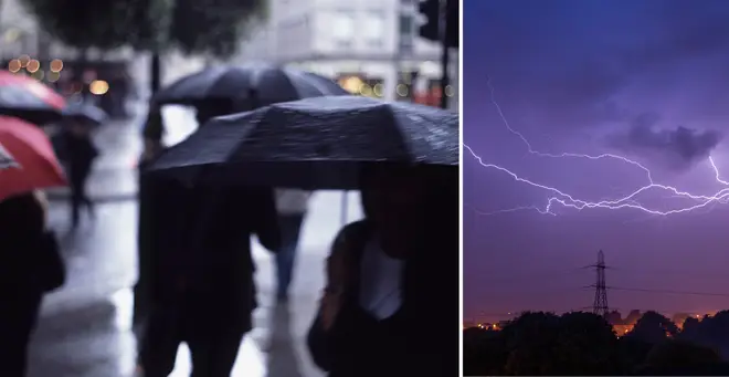
While downpours are expected across most of the country, many cities will also be hit by lightning into the afternoon today.
Commuters in Cardiff, Reading, Ipswich, Peterborough, London, Brighton and Birmingham should expect travel delays as the torrential rain and winds sweep across the country.
Meteorologist Becky Mitchell told The Express: “There will be plenty of showers forecast in the north and west, with some of them heavy particularly around the bristol channel area.
“South Wales and southwest England could have some thunder and downpours.
“The south will stay fairly mild with temperatures holding up in the double-figures.”
Good morning, breezy day with sunny spells and scattered showers, these heavy and possibly thundery in places, particularly across the south and SE during the afternoon. Driest across eastern Scotland and NE England with isolated showers here. https://t.co/Hjw1otqXUL ^Chris pic.twitter.com/FKIVUl8NxN
— Met Office (@metoffice) August 19, 2019
She continued: “But in the north there will be showers forecast from the word go.
Read More: Britain's set for spider INVASION as wet weather forces them indoors
“It will be a drier and brighter start in central and eastern parts as we head into the afternoon on Monday.
“We will see a little bit of cloud that will bubble up across the Midlands, East Anglia and southeast England.”
The showers are thought to ease in the south by evening with some sunshine creeping in, but in the north rain will continue through into the night.
The forecast states: "Showers dying away for most, although some lingering near northern and western coasts.
Read More: UK heatwave to RETURN as Asian typhoon brings hot weather back
"Parts of Northern Ireland, southern Scotland and far northwestern England may also keep showers throughout the night."
As well as sudden outbreaks of rain throughout the next few days, temperatures are set to stay in the low 20Cs, with conditions improving as the week goes on.
And it’s finally some good weather news, as arriving just in time for the August Bank Holiday weekend, a "tropical heat surge" could see temperatures reach above 25C.
Met Office forecaster Greg Dewhurst said: “There's an improvement after wet and windy weather, with plenty of sunny spells through the next week and 25C possible by the Bank Holiday weekend.
“Low pressure clears from Monday and high pressure slowly builds, with a southerly flow possible, with fewer showers in the south and east while the north and west remain less settled.
“High pressure looks like dominating in the last week of August - with mainly settled conditions and the mid-20s possible.”


