On Air Now
Heart Breakfast with JK and Amanda Holden 6:30am - 10am
11 April 2024, 11:58
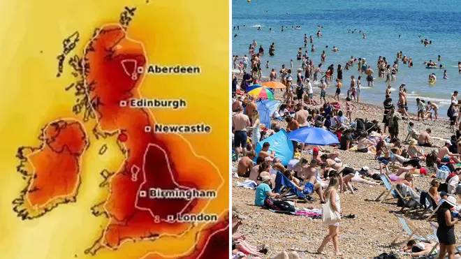
We can expect some high temperatures this week as a mini-heatwave is set to reach the UK shores.
It looks like summer is on its way as a mini-heatwave is set to arrive in the UK this week, with temperatures soaring to 20C, according to the Met Office.
After a stormy start to the year and a rainy Easter weekend, this hot weather will be a welcome arrival as we enter spring.
The heatwave is expected to begin at 1pm on Thursday the 11th of April, with temperatures climbing to 20C in the South East and East of England by 4pm. Parts of Scotland could also see temperatures of 18C, despite the muggy conditions.
This 72-hour African plume is predicted to continue through Friday and into Saturday before trickling off on Sunday, when more unsettled weather is due to hit the country.
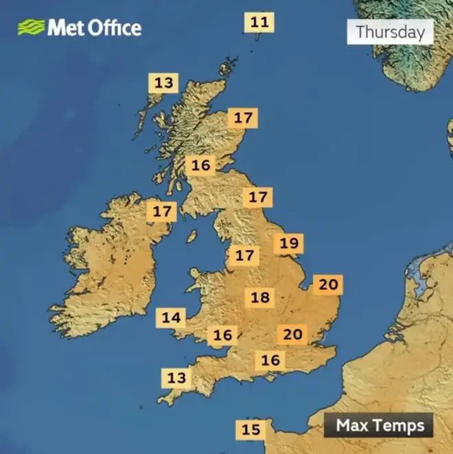
Annie Shuttleworth, a Met Office forecaster and expert stated: "Thursday is going to be a much drier and brighter day for most areas of the UK.
"By Thursday morning the rain band will set across the south coast where it tends to create the sort of waving features which will keep it across the south through much of Thursday. Further north though it will turn much clearer and drier."
She continued: I think as the afternoon progresses the sunshine will turn that much hazier as this band of rain starts to return from the south and west and actually across the south west of England, south west of Wales as well, likely to stay quite dull, possibly a bit drizzly through much of the day.
"So it’s going to be a bit cooler here compared to elsewhere but I think wherever you are you will definitely notice the humidity as it will start to be a little bit muggy. Highs of 20Cs are possible across parts of the south east but actually even up towards the north coast of Scotland we could see highs of about 17C or 18C."
However the weather is set to take a turn as the days go on, with the chance of snow possible.
The Met Office forecast from April 15-24 states: "Winds from the north or northwest are expected to affect the UK at the start of this period. This brings showers or some longer spells of rain, these most frequent across the north and northwest. Some heavy rain is likely at times with a risk of snow over high ground.
"However, further south conditions should be drier and brighter. Strong winds could also develop and temperatures will mostly be below normal. Through the rest of this period a change to milder conditions will probably occur. This is likely to be accompanied by a build of pressure, meaning more in the way of dry weather, especially in the south and east. Some rain is still possible at times, mainly in the northwest, but this should be less heavy than recently."
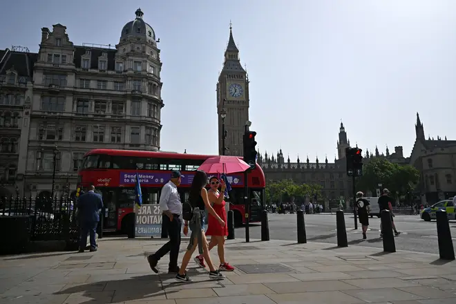
The heatwave is set to arrive in the UK on Thursday the 11th of April and continue into Saturday the 13th of April.
The mini-heatwave is set to end on Sunday the 14th of April when temperatures will dip and more unsettled weather will arrive in the UK.